What we do
River conditions tool
The Meagher County River Conditions Tool provides a visual and data-driven overview of river conditions for the Smith River in Meagher County.
- Real-time and historical water levels and flow rates
- Charts and graphs for trends over time
- Location-specific information for the Smith River
- Support for anglers, recreation, and informed decisions
Mining transparency initiative
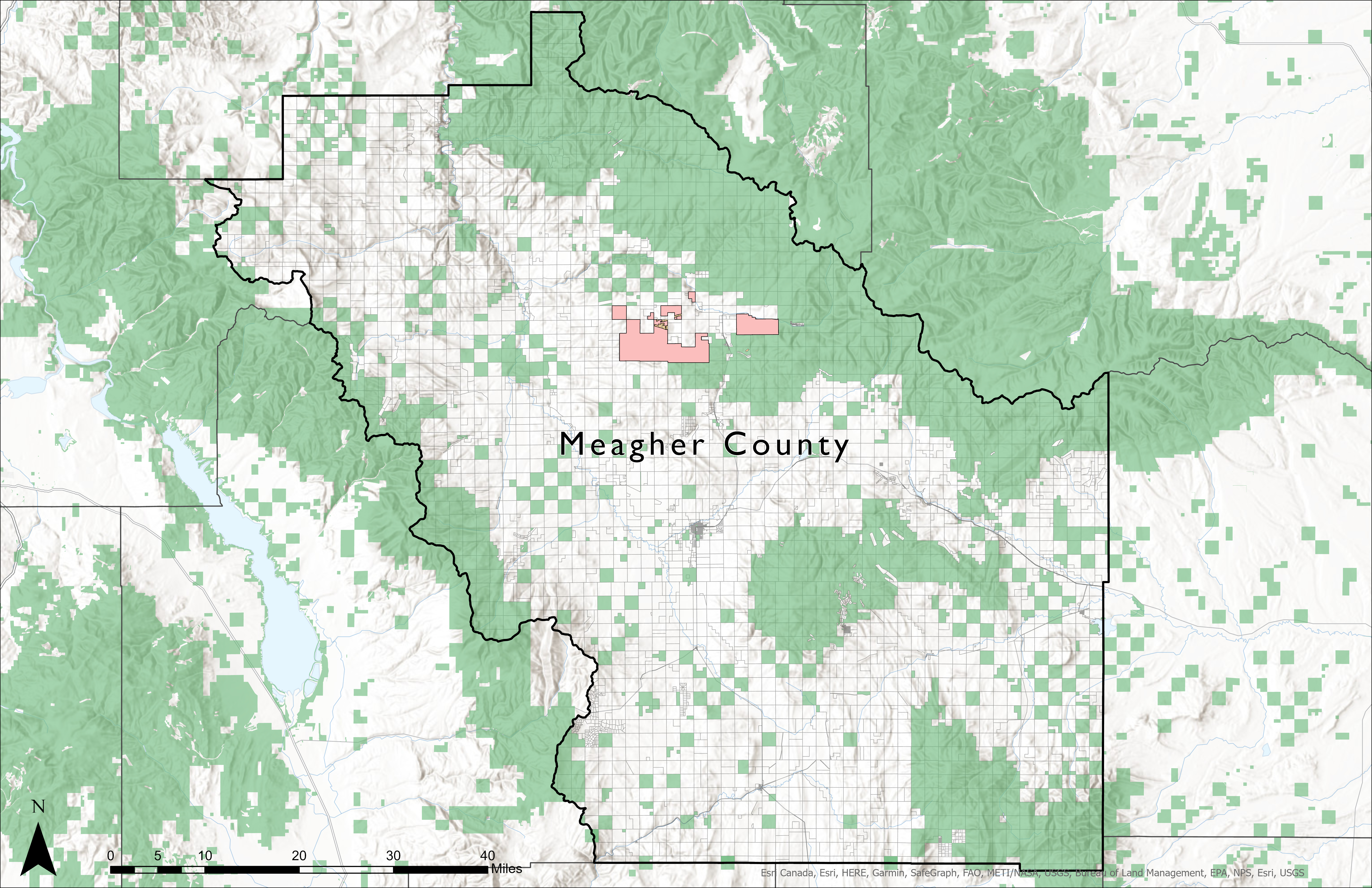
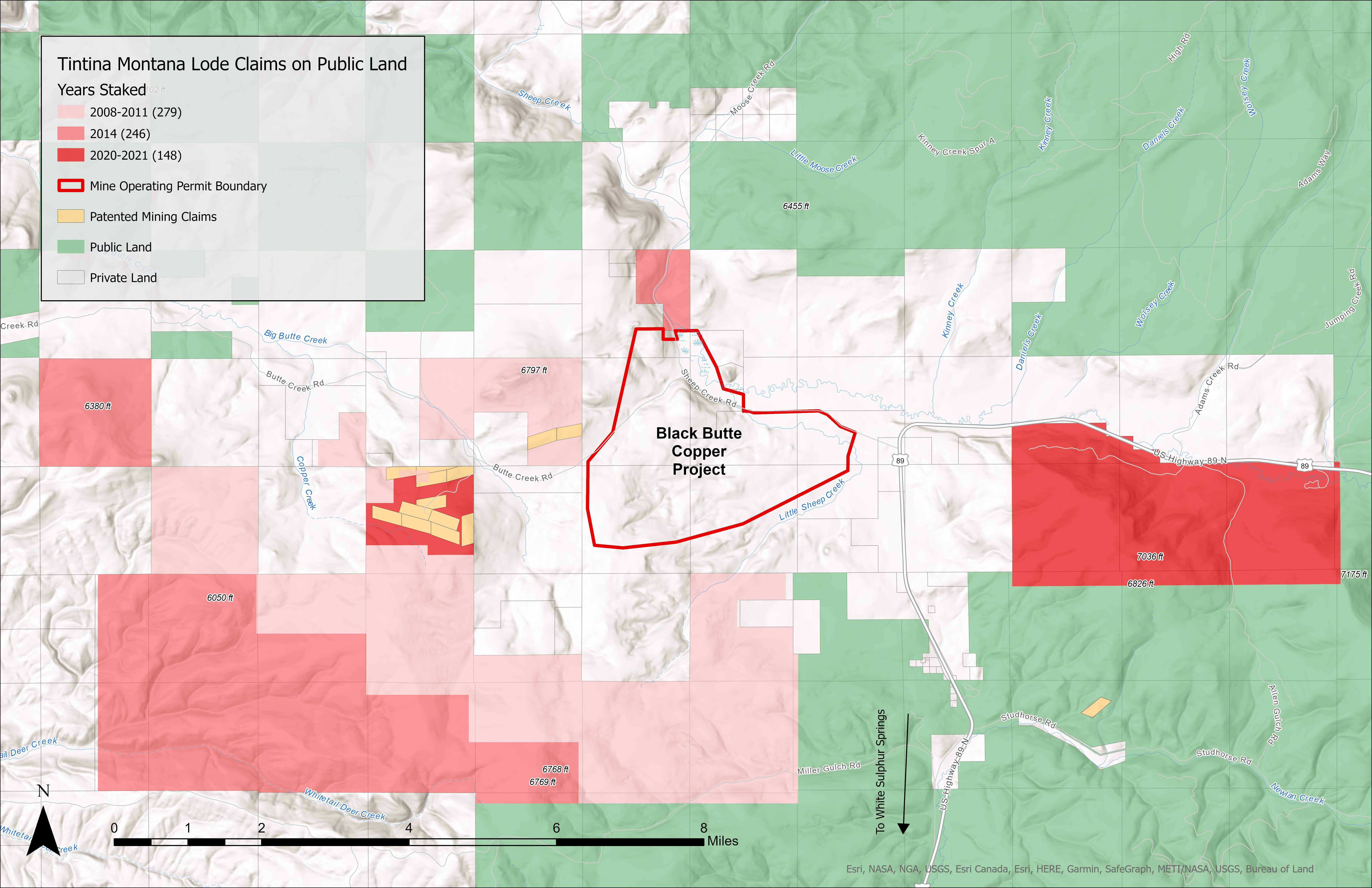
The MCSC has developed an interactive map showing mineral development activity around the Black Butte Copper Project, north of White Sulphur Springs. The map supports transparency into Tintina's exploration and permitted development in Meagher County, including the 2019 Mining Practices Agreement area where open pit mining is prohibited.
Learn more about mining claims: 43 CFR Part 3800; BLM MLRS.
No open pit
Mining Practices Agreement (PDF)